Sign up for the paNOW newsletter

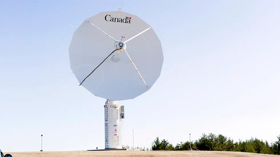
Prince Albert Satellite Station benefits global efforts

Apr 30, 2018 | 10:00 AM

While many different industries have historically operated in Prince Albert, very few operate on the same scale as the satellite station west of the city.

Established in the late 1950s and repurposed in 1971, the Prince Albert Satellite Station has undergone several facelifts over the years to adapt to rapidly-advancing technology. The station’s antennae collect information from a number of satellites passing overhead, which work as part of a global network collecting data for stakeholders or governments for different purposes.

“We can see oil spills in the ocean, we can see crop health, we can see forest fires, we can see damage from forest fires.” Station Manager Kevin Adams said.

For example, Adams said Environment Canada has collected information gathered by satellites passing through the northern portions of North America to create ice floe maps. The same department used imagery to study the impacts of climate change.

The information gathered at the Prince Albert Satellite Station isn’t just used in Canada, Adams said. Global collaboration is a big part of what happens at the satellite station, and partners around the world share the information gathered by the satellites for their own research or data-collection purposes. An agreement also exists to monitor world events or natural disasters. Last year, Adams explained, the Prince Albert station monitored at least 14 different major global events including the B.C. wildfires.

The station’s purpose and technology have changed numerous times over the years. When it was first opened, the station helped collect information from satellites in order to conduct different kinds of research work. In the late 1960’s, the station’s activities were put on hiatus until the United States decided to launch a satellite for global mapping purposes. In 1971 the station was retrofitted to aide that initiative. The most recent upgrades to the facility took place in 2015, Adams said, and the current station, which is operated by Natural Resources Canada, will last until 2035.

The station manager said the most recent round of upgrades also brought about more automation, which helps make Canada’s network one of the most automated satellite systems in the world.

Adams, who started work at the station over 30 years ago, said Prince Albert’s geographic location near the centre of Canada, along with the fact there was already a station with at least one antenna here, made the location appealing to the federal government. From the Prince Albert antennae, information can be collected from as far north as Greenland and as far south as Mexico. The Inuvik station, which was established in 2010, allows Natural Resources Canada to gather information from the arctic regions, and the station in Gatineau covers much of North America’s Eastern Seaboard. All three stations are monitored and remotely operated by staff at the Prince Albert location.


Bryan.Eneas@jpbg.ca

On Twitter: @BryanEneas